gmina Stara Kamienica
| Stara Kamienica | |
|---|---|
| Województwo: Voivodeship: | dolnośląskie |
| Powiat: District: | jeleniogórski |
| Gmina: Commune: | Stara Kamienica |
| Rodzaj gminy: The surface of the area designed for investment: | wiejska |
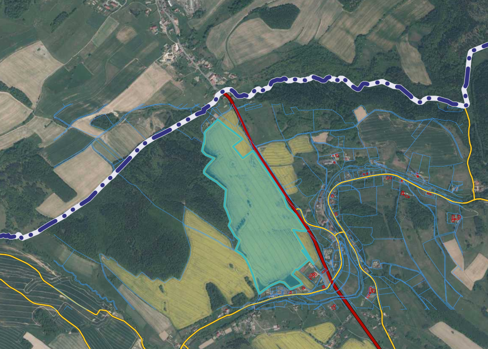
| Powierzchnia terenu przeznaczonego na inwestycję: Number of plot’s precinct: | 27 |
| Nr obrębu działki: Number of the plot being part of the investment offer: | 2 |
| Nr działki stanowiącą ofertę inwestycyjną: Number of the plot being part of the investment offer: | 306/45 |
| Powierzchnia działki: Plot’s surface [ha]: | 33,21 |
| Lokalizacja działki: Plot’s location : | Gmina Stara Kamienica, Sołectwo Barcinek |
| Miejscowy plan zagospodarowania przestrzennego: Local zoning plan: | TAK/YES Uchwała nr XII/90/11 Rady Gminy Stara Kamienica z dnia 30 sierpnia 2011 r. dla obrębu Barcinek |
| Odległość sieci wodociągowej: (m) Distance from the plot to the water supply network: [m] | 600 |
| Odległość sieci kanalizacyjnej: (m) Distance from the plot to the sewage system: [m] | 600 |
| Odległość sieci elektroenergetycznej: (m) Distance from the plot to the power network: [m] | 0 |
| Odległość sieci gazowej od działki: (m) Distance from the plot to the gas network: [m] | 8500 |
| Odległość drogi dojazdowej od działki: Distance from the plot to the road: | 0 |
| Odległość od autostrady/drogi ekspresowej: Distance from the plot to the motorway/ expressway: | 50 km |
| Czy działka znajduje się na terenie zalewowym: Is the plot at the area of floodplain ? | NIE/NO |
| Klasa bonitacyjna gleby działki: Soil bonitation class of the plot: | IVa, IVb |
| Czy działka wymaga odrolnienia: Does the plot require changing the status of farmland ? | NIE/NO |
| Czy teren działki posiada badania geologiczne gruntu: Does the plot’s area have any geological research background ? | NIE/NO |
| Link do dodatkowych informacji: Additional data: | - |
| Uwagi, informacje dodatkowe: Comments: | - |
| Link do map: Link to the maps: | - |